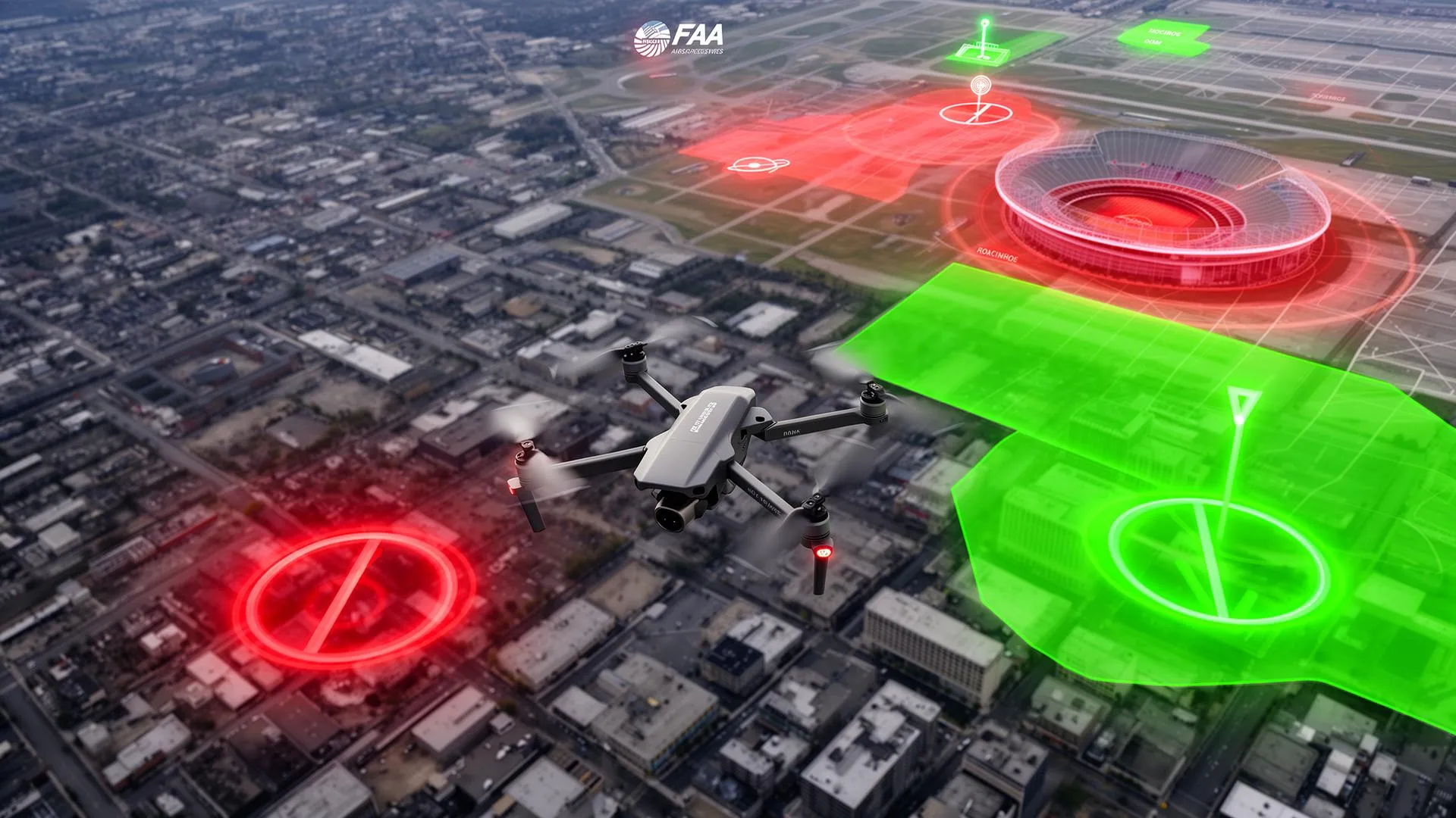
Germany gives you a lot of open sky, but a surprising amount of it is fenced off for drones. Airports, nature reserves, residential plots, prisons, power plants, motorways, federal buildings and crowds all carry their own no-fly or restricted status under German law. This guide explains the main forbidden and restricted geographical zones (geografische Gebiete) for 2026, the 120 m height ceiling, exactly how to check a spot before you fly, and where to apply for permission, with every figure linked to the German aviation regulation, DIPUL, DFS or EASA so you can verify it yourself.
The one habit that keeps you legal: never trust your memory of the rules, trust the map. Open the official DIPUL map tool, drop a pin on your exact take-off spot, and read what comes up before every flight. The same field can be clear on one day and inside a temporary restriction the next.
The legal starting point: airspace is free, except where it isn't
In Germany the use of airspace by drones is, in principle, free. The restrictions come from the geographical zones (geografische Gebiete) defined under Section 21h of the German Rules of the Air (Luftverkehrs-Ordnung, LuftVO), which list the areas where drone operations are excluded, restricted, or only allowed under conditions (§ 21h LuftVO). These zones exist for the same four reasons EASA gives EU-wide: safety, security, privacy, and the environment (EASA geo-zones). The official platform that visualises every § 21h zone in Germany is DIPUL, the Digitale Plattform Unbemannte Luftfahrt run by DFS (DIPUL geographical zones).
Geo-zones sit on top of, not instead of, the general open-category rules. You still need a registered operator e-ID and (for most camera drones) the competency proof before you go near any of this. If you have not done that yet, start with our step-by-step guide to registering a drone in Germany, then come back here to learn where you are actually allowed to put it in the air.
The 120 m height ceiling
Across the EU open category, the maximum height is 120 m above the closest point of the surface of the earth (EASA). That is a hard ceiling for almost all recreational and light commercial flying in Germany, and it applies on top of every horizontal zone restriction below. Going higher generally pushes you out of the open category and into the specific category, which needs an operational authorisation. For the full picture of what the open category allows, see our guide to EU drone regulations.
The main forbidden and restricted zone types
Section 21h LuftVO defines the geographical zones as a numbered list. Some are flat bans, others allow flight only with a lateral distance, an owner's consent, or an authority's approval. The table below summarises the headline zones and the distances that matter most in practice (§ 21h LuftVO, DIPUL legal basis).
| Zone type | Rule |
|---|---|
| Airports (Flughäfen) | No flying within 1,000 m of the airport boundary, plus a corridor along the extended runway centrelines; flight in the surrounding control zone needs ATC clearance. |
| Aerodromes (other airfields) | No flying within 1.5 km of the boundary of airfields that are not airports. |
| Control zones | Flight only with air traffic control clearance. |
| Nature reserves, national parks, Natura 2000 | Flying over is prohibited unless the competent nature-protection authority approves it; below 250 g without a camera is treated more leniently. |
| Residential property (Wohngrundstücke) | Flying over is restricted: needs the owner's consent, or the drone is under 250 g, and a night/quiet-hours restriction applies. |
| Federal/state government bodies, police, diplomatic missions | No flying within 100 m lateral distance. |
| Industrial plants, prisons, military sites, energy facilities | No flying within 100 m lateral distance. |
| Federal trunk roads, federal waterways, railways | No flying within 100 m lateral distance (crossing at a safe height is treated separately). |
| Hospitals | No flying within 100 m lateral distance. |
| Accident and emergency operation sites | No flying within 100 m; never interfere with rescue or police operations. |
| Crowds (Menschenansammlungen) | No flying over assemblies of people in the open category. |
Several of these distances are the recurring 100 m lateral minimum that § 21h applies to sensitive infrastructure: industrial installations, correctional facilities, military organisations, central energy generation and distribution sites, the premises of constitutional bodies and supreme federal and state authorities, diplomatic and consular missions, police and security authorities, federal trunk roads, federal waterways, railway installations, and hospitals (DIPUL legal basis).
⚠️ Airports are bigger than the fence line
The 1,000 m airport buffer is only part of it. § 21h adds a corridor that runs out along the extended centrelines of the runways, so the restricted shape is far longer than a simple circle. This is exactly why eyeballing distance never works near an airport: let the DIPUL map draw the actual polygon for you.
Nature reserves and residential plots: the two that catch hobbyists
The two zones that trip up casual pilots most often are nature reserves and residential property. Flying over a nature reserve, national park, or comparable protected area is prohibited unless the responsible nature-protection authority has approved it (§ 21h LuftVO). That beautiful empty heath or lakeside you spotted is very often exactly the kind of land that is protected, which is why it looks empty in the first place.
Flying over residential property is restricted too: it generally requires the consent of the property owner, with an exception for very light drones, and quiet-hours protections apply. The privacy rationale is explicit in the EASA framework, so even where a flight is technically allowed, pointing a camera into someone's garden is a separate legal problem (EASA geo-zones).
How to check a location before you fly
DFS and DIPUL provide official, free tools so you never have to guess. The core workflow is short:
- Open the DIPUL map tool. Go to the official map at maptool-dipul.dfs.de, type in your address, or drop a pin on the exact take-off spot (DFS drone FAQ).
- Read every layer that lights up. The tool shows whether your spot falls inside a control zone, an airport or aerodrome buffer, a nature reserve, an ED-R restricted area, or one of the 100 m infrastructure zones, all derived from § 21h LuftVO (DIPUL).
- Check for temporary restrictions. Use the DFS AIS portal for free NOTAM briefings at ais.dfs.de to catch short-notice closures the static map will not show (DFS).
- Use a flight-planning app in the field. The DFS Droniq app brings the same zone data to your phone for on-site checks; details are on the DFS drone-flight pages and at droniq.de (DFS).
If you are coming from a country with a different system, the contrast is useful: the US relies on the LAANC system and the B4UFLY app rather than a single national map. Our breakdown of US drone no-fly zones shows how the same idea plays out under the FAA, and a registered remote-identification setup matters in both regions, as covered in our Remote ID compliance guide.
Where to get authorisation when a zone blocks you
A geo-zone is not always an absolute wall. Depending on the zone type, you can apply for clearance or an exemption:
- Control zones (around airports): apply to DFS for clearance through the AIS pilot service for drone flights in control zones (DFS drone FAQ).
- Nature reserves and national parks: approval comes from the competent nature-protection authority of the federal state, not from DFS (§ 21h LuftVO).
- Other restricted § 21h zones: where you cannot obtain the operator's or the relevant authority's consent, you can apply for an exemption (Ausnahmegenehmigung) from the aviation authority of the federal state in which the zone lies (DIPUL).
Authorisation takes time and is never guaranteed, so plan well ahead and keep the written approval with you on the day. For higher-risk operations that exceed open-category limits, you move into the specific category and a full operational authorisation, which is a different process again.
Bottom line: stay at or below 120 m, keep 100 m clear of sensitive infrastructure, never fly over crowds, nature reserves, or residential plots without the right consent, and check the DIPUL map for your exact spot before every single flight. When the map says no, the legal route is an application to DFS, the nature authority, or your state aviation authority, never an improvised flight.
Frequently Asked Questions
How do I find out where I can fly my drone in Germany?
Use the official DIPUL map tool at maptool-dipul.dfs.de, run by DFS. Enter your address or drop a pin on your exact take-off spot, and the map shows whether you are inside a control zone, an airport or aerodrome buffer, a nature reserve, or one of the 100 m infrastructure zones defined by Section 21h LuftVO. Then check the DFS AIS portal for any temporary NOTAM restrictions on the day. Checking the map before every flight is the single most reliable way to stay legal.
What is the maximum height I can fly a drone in Germany?
In the EU open category, which covers almost all recreational and light commercial flying, the maximum height is 120 m above the closest point of the surface of the earth, as set out by EASA. That ceiling applies on top of every horizontal geo-zone restriction. Flying higher generally moves you into the specific category, which requires a separate operational authorisation.
Can I fly a drone over a nature reserve or national park in Germany?
Generally no. Under Section 21h LuftVO, flying over nature reserves, national parks, and comparable protected areas is prohibited unless the competent nature-protection authority of the federal state has approved it. These approvals come from the nature authority, not from DFS, and are not guaranteed. The empty, scenic land that looks ideal for filming is very often protected for exactly that reason, so always check the DIPUL map first.
How far do I have to stay from airports, infrastructure, and buildings?
Section 21h LuftVO sets a 1,000 m no-fly buffer around airports (plus a corridor along the extended runway centrelines) and 1.5 km around other aerodromes. A recurring 100 m lateral minimum applies to industrial plants, prisons, military sites, energy facilities, government and police premises, diplomatic missions, hospitals, federal trunk roads, federal waterways, and railways. Because the shapes are irregular, especially near airports, use the DIPUL map rather than estimating distance by eye.
How do I get permission to fly in a restricted zone?
It depends on the zone. For control zones around airports you apply to DFS for clearance through the AIS pilot service. For nature reserves and national parks you apply to the competent nature-protection authority of the federal state. For other Section 21h zones where you cannot get the operator's or the relevant authority's consent, you can apply for an exemption (Ausnahmegenehmigung) from the aviation authority of the federal state in which the zone lies. Allow plenty of time and carry the written approval with you.
Can I fly my drone over my own house or someone else's residential property?
Flying over residential property is restricted under Section 21h LuftVO. It generally requires the property owner's consent, with an exception for very light drones, and quiet-hours protections apply. Even where a flight is technically permitted, EASA highlights privacy as a core reason for geo-zones, so filming into a neighbour's garden can still be a separate legal issue regardless of the airspace rule.